

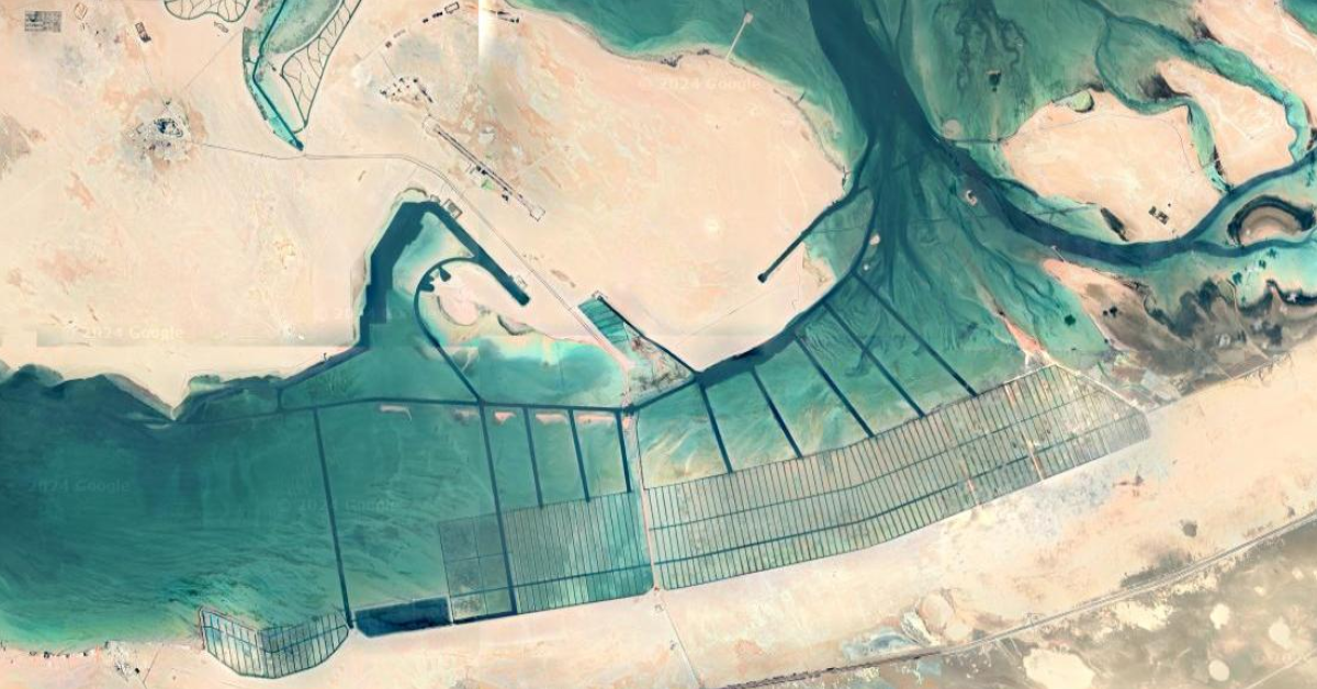
Found on a google maps trip to Al Jirab, Along the E11 24°05’14.0"N 53°55’27.0"E
I found this while looking for interesting places to share on the Top View community here on Lemmy

After some more research, the most likely candidates:
mangrove nurseries, salt harvesting, algae farm, coral nurseries.
But nothing yet is confirmed!


 -----
-----
I think I may have found the answer? After researching a little bit it looks like Abu al Abyad, the island above the elongated rectangles is actually an international military testing facility. This article , and a couple similar to it alluded that the area is for testing naval equipment and amphibious landings.
There are similar man made pools of salt water in desert condition that the US utilizes for radar testing at the China Lake research facility in California.